
Schelde- en Durme-estuarium van de Nederlandse grens tot Gent
Image
General Description
The tidal area of the Scheldt is a unique melting pot of functions. It is simultaneously an economic hub, a densely populated area, an internationally renowned natural phenomenon, and a paradise for walkers and cyclists eager to experience its rich blend of nature and culture. Equally characteristic of the Scheldt are the severe floods that have historically shaped its valley. The Scheldt is often referred to as the lifeline of Flanders.
Identification
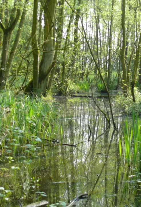
The Scheldt and Durme estuary stretches from Ghent to the Dutch border north of Antwerp, covering parts of the provinces of Antwerp and East Flanders. More than half of the area consists of mudflats, salt marshes, and deep to shallow water zones. Scattered across the river valley are marshes, wet grasslands, and wet forests. On a smaller scale, there are also fossil river dunes with dry grasslands, heathlands, and woodlands.
Landscape Description
Tides are felt up to the locks of Ghent, about 160 kilometers from the sea. Salt and fresh water mix here, creating a unique transitional zone between river and sea. Downstream, the fresh water gradually becomes brackish and eventually saline in the Netherlands. The river is constrained by high dikes and consists of open water, mudflats, and salt marshes. The river valley has long been cultivated by humans (for agriculture, housing, ports...). Species-rich grasslands and marshes have survived here and there despite the intensification of land use after the Second World War.
Who is Active in the Area
A wide range of stakeholders from various sectors are active in this extensive area. It is situated within the Flemish Diamond, the urbanized region between Ghent, Antwerp, and Brussels. Thanks in part to the world port of Antwerp, this region is home to many economic players. The Scheldt valley is also an important agricultural area. The remaining natural values are managed by various conservation organizations. Thanks to its natural areas and a few cultural and historical gems, the tourism sector is also active here. For government agencies such as the Agency for Nature and Forests, Mobility and Public Works, and Waterways and Sea Canal, a significant part of their operational area lies within this region.The wide variety of biotopes on the coast, such as the typical mudflats and salt marshes, drifting dunes, dune valleys... attract unique plants and animals. This Special Protection Zone includes most dune areas on our coast, as well as the IJzer estuary, the Zwin and some inner dunes. This Habitats Directive area largely overlaps with the Bird Directive Area West Coast and partly with the Zwin Bird Directive Area. There is a wide variety of biotopes in the dune areas, with transitions from saltwater mudflats and salt marshes, beaches (with local fore dunes) over calcareous and more calcareous dunes to polders.
Click here for more information about the 'Polders van Kruibeke', an area within the N2000-area!
Click here to go to the Bioblitz page of this Natura 2000 area.
Click here to install Obsidentify.
Photo: Polders van Kruibeke, Laurent Van den Abeele
Video file